This past Saturday, Cliff, N4CCB hosted the WCARES Virtual Monthly Meeting. The agenda was:
ARES Task Book – member progress update by Ed Hudgens (WB4RHQ)
Field Day recap by Cliff Batson (N4CCB)
GRLevel3 Presentation by Adam DeLand (W8IFG)
First Virtual Ham Shack Tour by Cliff Batson (N4CCB)
ARES Task Book & Field Day Recap: https://youtu.be/kdIGymaG0jg
Ed provided an update on the progress of members who are pursuing the ARES Task Book and Cliff and provided a recap of this year’s unique Field Day event that saw WCARES members participating while social distancing. The ARRL introduced waivers for this year allowing home stations (Class D) to work other home stations and to allow for aggregating individual scores as a “club score”.
Adam’s GRLevel3 presentation to WCARES: https://youtu.be/yoTVI9PhvUc
Adam, W8IFG gave a detailed presentation on GRLevel3 http://grlevelx.com/grlevel3_2/, with particular emphasis on expanded functionality using shapefiles and placefiles. Adam demonstrated various use cases like adding route and rest stop information to the map for a cycling event like Jack and Back and adding more detailed local street layers or feeds of dynamic information such as APRS beacons for weather spotters. Adam has another longer presentation and demonstration done last year for DCARES: https://youtu.be/knHRLZQ_N78 .
Virtual Ham Shack Tour by N4CCB: https://youtu.be/UqUdav1yp4Y
Cliff wrapped up the meeting with the first virtual shack tour, giving us a tour of his second floor radio shack. Cliff talked about his limited but effective HF antenna situation, his solutions for running coax from the shack and what gear he has set up on his radio desk. Cliff enjoys operating portable and likes using a simple wire antenna such as those from SOTABEAMS ( https://www.sotabeams.co.uk/antennas/ ). During the discussion Tim, AD4CJ recommended the https://www.sotamaps.org/extras HF Linked Dipole Antenna Designer tool.
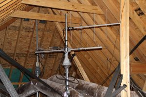
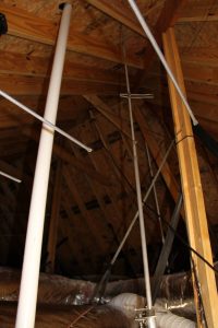
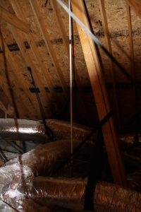
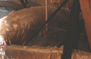
Cliff also talked about his mag-mount VHF/UHF antenna on a filing cabinet and this led to some discussion of VHF/UHF antenna solutions, particularly those which can be used indoors or in antenna-restricted environments. Bob, AK4RO and Mark, KA4BKA both like the PVC or the rollup versions of Ed Fong WB6IQN’s antennas ( https://edsantennas.weebly.com/ ) while Paul, WD9IOK has some ingenious solutions for antennas in the attic of his house. As Paul pointed out, there is no wind load in your attic and he used 1 1/4″ or 1 1/2″ pipe threaded into a flange mounted on a 1×10 x 32″ board and anchored to the attic beams to make a small platform. And Tim mentioned the Ventenna solution from https://www.ventenna.com/ .
Ed will be doing the Virtual Shack tour next month with tours by other WCARES members to follow.
Some of Paul’s attic setup:
